Tropical Cyclone Owen Could Cross Near Townsville
Strong winds and rain expected
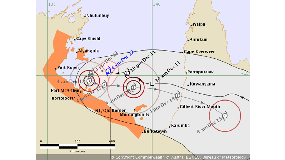
The Bureau of Meteorology. Issued at 5:53 am AEST Wednesday 12 December 2018. Refer to Tropical Cyclone Advice Number 12.
It could be a wet, windy and wild weekend for North Queensland.
Tropical Cyclone Owen has reformed in the Gulf of Carpentaria overnight.
The Bureau of Meteorology models have it tracking across the peninsula and through to the east coast over the next few days.
Forecaster Sam Campbell said they are predicting it to cross somewhere around Townsville and track along the coast as a low.
“It does look like it could pack quite a punch as it moves along the east coast of Queensland” he said.
The system is expected to bring strong winds to large parts of the state when it crosses land Friday afternoon.
“The damaging and destructive wind gusts could bring down large trees and take off roofs” Mr Campbell said.
It is also expected to bring a large amount of rain, with totals of 200 millimetres possible.
The Department of Agriculture and Fisheries are taking the advice seriously.
They will start pulling out the shark nets and drumlines from Townsville beaches tomorrow and Friday.
Shark Control Program Manager Sam Fary said it is as a precaution.
“We will continue to monitor the system, and the shark control gear will go back in the water when it is safe to do so” he said.
The Bureau of Meteorology wants us to keep up to date with the latest on Tropical Cyclone Owen, clean up around the home and check our cyclone kits.
Stay tuned to HIT 103.1 for the latest on the cyclone or follow it on the Bureau of Meterology cyclone site.