The latest on the tropical low off the Far Northern coast from the Bureau of Meteorology.
See all the details here.
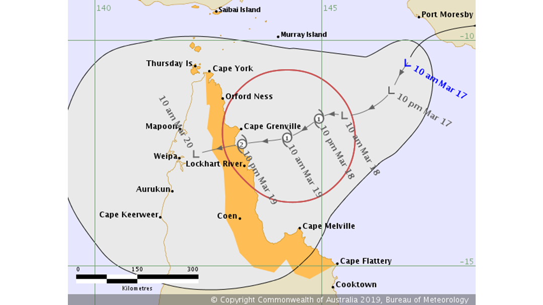
The latest advice straight from the Bureau of Meteorology about the tropical low off our Far North coast:
Intensity: Tropical Low, sustained winds near the centre of 45 kilometres per hour with wind gusts to 85 kilometres per hour.
Location: within 55 kilometres of 10.5 degrees South 146.9 degrees East, estimated to be 465 kilometres east northeast of Lockhart River and 730 kilometres north of Cairns.
Movement: slow moving.
The tropical low is expected to continue tracking in a general westwards direction towards the far north Queensland coast over the next couple of days. At this stage, the system is rated a high chance of forming into a tropical cyclone on Monday and is forecast to reach category 2 intensity prior to moving onto the far north Queensland coast late on Tuesday or during Wednesday.
Hazards:
GALES, with gusts in excess of 90 km/h, may develop between the Torres Strait Islands and Cape Flattery on Tuesday. DESTRUCTIVE WINDS, with gusts in excess of 125 km/h, may occur about a small stretch of the far north Queensland coast if the system reaches category 2 intensity prior to moving onto the coast late on Tuesday or during Wednesday.
As the cyclone crosses the coast late on Tuesday or during Wednesday, ABNORMALLY HIGH TIDES are expected about the far north Queensland coast. Large waves are likely along the beachfront.
HEAVY RAINFALL, which may lead to flash flooding, is forecast to develop across far north Queensland over the next few days.
Recommended Action:
People between the Torres Strait Islands and Cape Flattery should consider what action they will need to take if the cyclone threat increases.
- Information is available from your local government
- For cyclone preparedness and safety advice, visit Queensland's Disaster Management Services website (www.disaster.qld.gov.au)
- For emergency assistance call the Queensland State Emergency Service (SES) on 132 500 (for assistance with storm damage, rising flood water, fallen trees on buildings or roof damage).
Next Advice:
The next advice will be issued by 5:00 pm AEST Sunday 17 March.
For all the latest updates please see their website HERE.