More Hunter Suburbs At Risk Of Rising Sea Levels
It follows updated modelling
It's feared more parts of the Hunter could end up under water than we first thought, as a result of rising sea levels.
Updated research from the US National Oceanic and Atmospheric Administration (NOAA) shows the giant ice sheets of Antarctica and Greenland are melting faster previously estimated.
Previous modelling indicated the 'worst case' scenario was going to be a 74 centimetre sea level rise by 2100.
The new modelling now indicates that's the 'most likely' scenario.
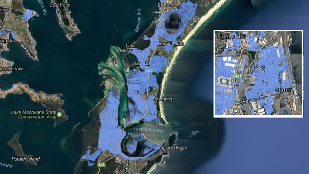
Coastal Risk Australia has released new mapping, which combines the new forecast along with high-tide data.
It shows areas around Swansea, Carrington, Hexham, Raymond Terrace and Anna Bay are among those most likely to be inundated.
“Anyone can look at these maps and visualize exactly how sea-level rise, driven by climate change, will permanently alter our coastline and neighbourhoods," website creator Nathan Eaton said.
"We already knew this was going to be bad news for low-lying areas, but the latest science is telling us to brace for even worse."


Images: Coastalrisk.com.au **These are estimates and should be relied upon for site specific decision making.